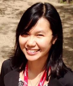
 Qian (Rachel) Lei-Parent recently joined our Middlesex County Extension Center and UConn Center for Land Use Education and Research (CLEAR) as an assistant extension geospatial educator. Qian has both of her B.S and M.S in Land Resources Management from Wuhan University, China. She received her Ph.D in natural resources from University of Connecticut focusing on GIS and remote sensing.
What is your area of interest and how did you get started with it?
My research interests are using GIS and remote sensing to help with problems relating to natural resource management and the environment. I first started working with GIS in college while studying GIS and land surveying at Wuhan University, China. When I came to UConn as a PhD student, I started to specialize in natural resource applications.
What is your role with UConn Extension?
My current role at CLEAR is to perform geospatial analyses and develop web-based mapping tools to support studies and projects relating to land cover, water quality, and other environmental issues.
What excites you the most about working with UConn Extension?
I enjoy the challenge of solving technical problems and being part of a dedicated and supportive team that helps communities solve their natural resource and environmental problems. The projects are always different, which keeps it interesting.
What is one thing you hope people will learn from you and your work?
Geospatial technology is not only about making maps, but it is also a powerful tool for solving problems.
What is your favorite thing to do in Connecticut?
Biking along the Connecticut river.
What are some of your hobbies and other interests?
I enjoy hiking, rock climbing, and traveling around to appreciate outdoor scenery and taste different food. I also like craft painting, gardening and watching comedy movies.