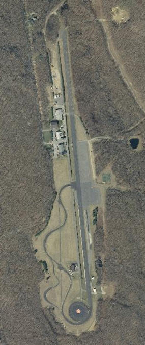
Connecticut (and the rest of the world for that matter) looks so different from above than from the ground. I spend a good deal of time looking at aerial imagery of Connecticut including different color combinations, times of year (leaves or no leaves) and different years to see change. There are many places that I have discovered and would never have known about otherwise. I have collected a few favorites. See if you can identify (1) what each spot is and (2) where it is. Give it a try. Answers are hiding in a map at the end. Feel free to comment in the blog and let us know how you did.
By the way, these images were captured by airplanes in March of 2012 when the trees didn’t have leaves but the snow had melted. To learn more about this valuable, statewide data set (paid for by CT DESPP, CT DOT and NGA), visit CT ECO or see my earlier blog.
1)